Chinatown Atlas

  • Home
  • Eras
  • Stories
  • Maps
  • Graphics
  • Archives
  • Resources
  • About Us

Archives

6. Garment Dist. – 1930 Beehive Map

1930 – Beehive Map

Leave a comment

2. Garment Dist. – Map

1902 – Beehive Map

Leave a comment

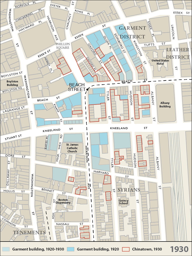
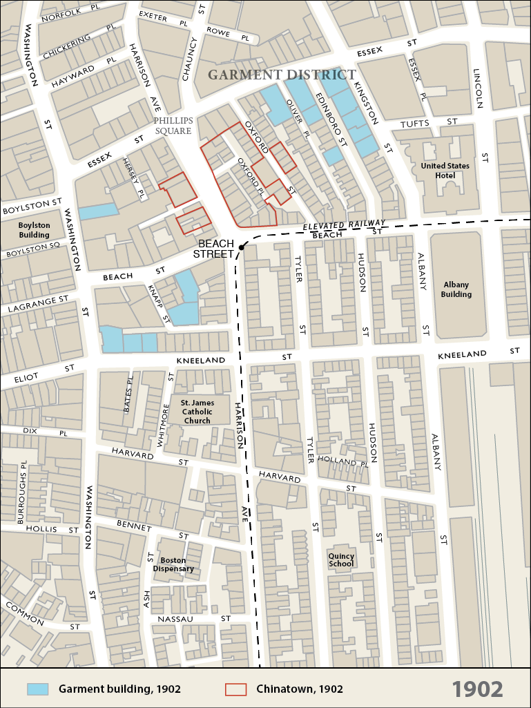
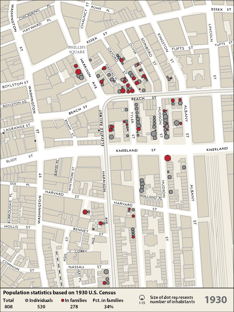
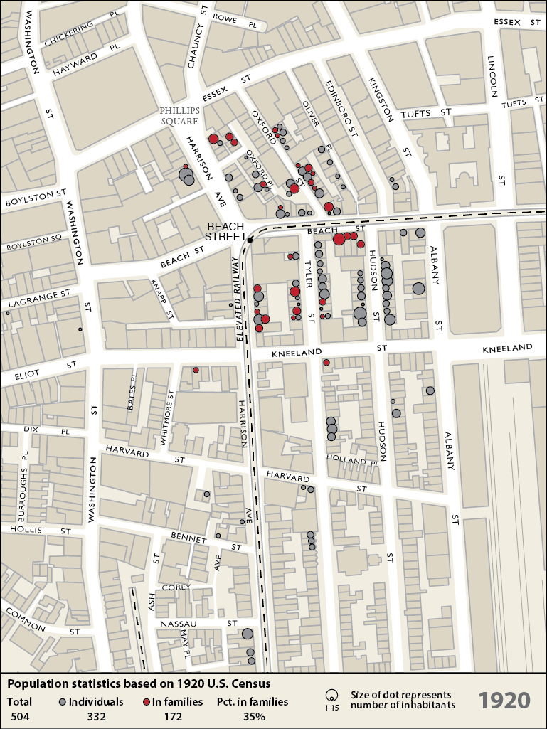
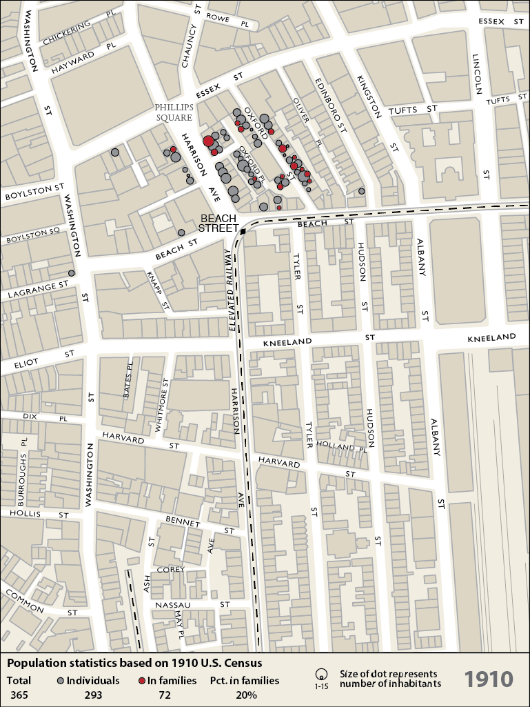
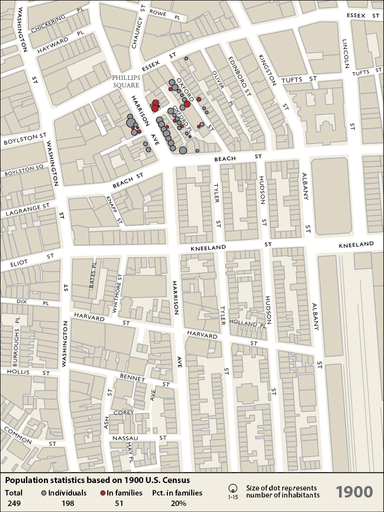
1. Garment Dist. – Map – Randall Imai

The distribution of garment buildings (blue) and Chinatown buildings (brown) circa 1930. Diagram by Randall Imai.

Leave a comment

Census_1940_Web_Census

Leave a comment

Census_1930_Web_Census

Leave a comment

Census_1920_Web_Census

Leave a comment

Census_1910_Web_Census

Leave a comment

Census_1900_Web_Census

Leave a comment

Chinatown_2014

Leave a comment

Chinatown_1988

Leave a comment

Posts navigation

← Older posts

Recent Comments

    Archives

    Categories

    • Community
    • Context
    • Elevations
    • Graphics
    • Personal
    • Stories
    • testcat
    • Then & Now

    Meta

    • Log in
    • Entries feed
    • Comments feed
    • WordPress.org

    Pages

    • About Us
    • Archives
    • Consolidation Era
    • Expansion Era
    • Home
    • Maps
    • Resources
    • slider test
    • Stories
    • Strengthen Era
    © 2023 Chinatown Atlas.