Chinatown Atlas

  • Home
  • Eras
  • Stories
  • Maps
  • Graphics
  • Archives
  • Resources
  • About Us

Archives

7. Garment Dist. – Buildings

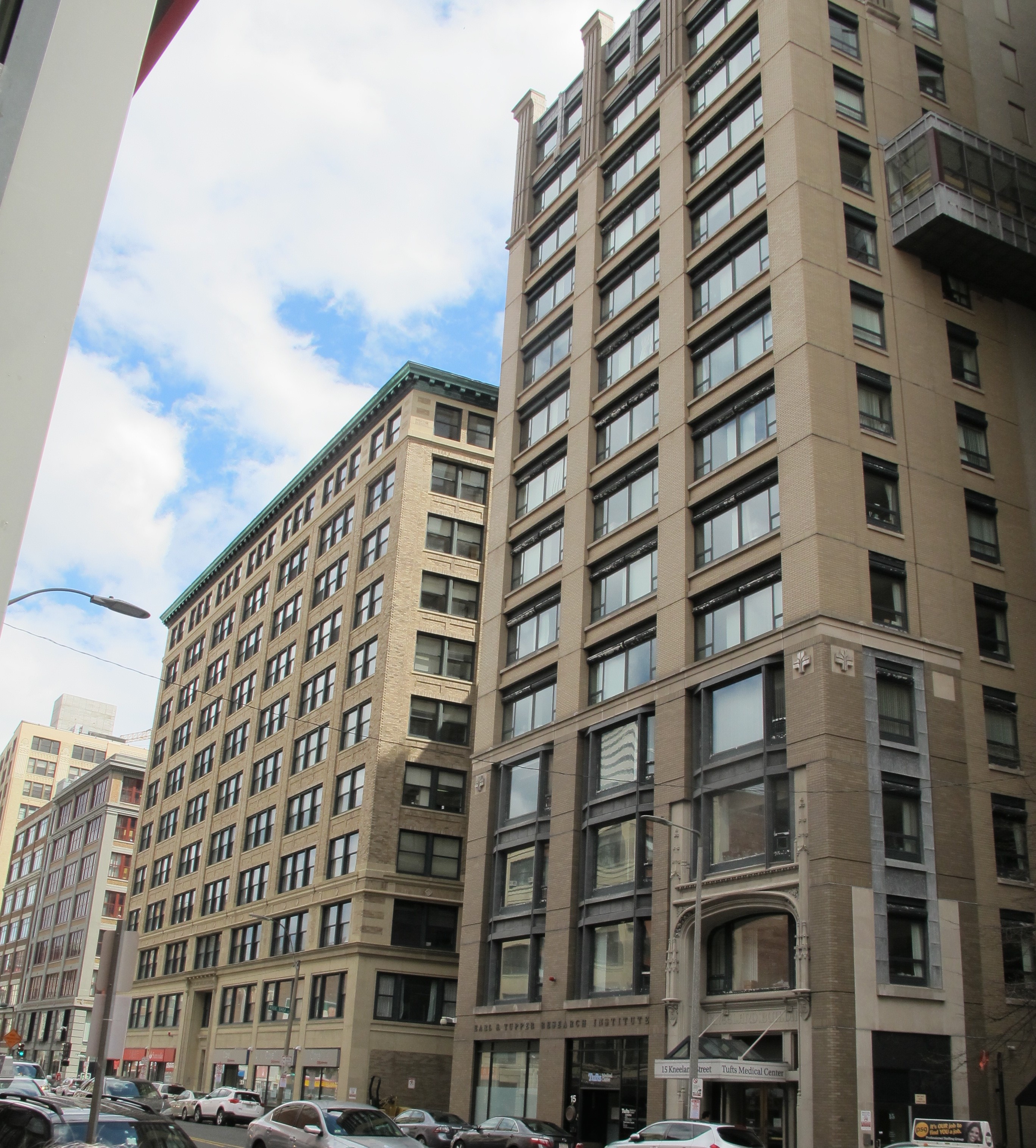
South side of Kneeland St.with garment buildings built in the 1920s.

Leave a comment

4. Garment Dist. – Buildings

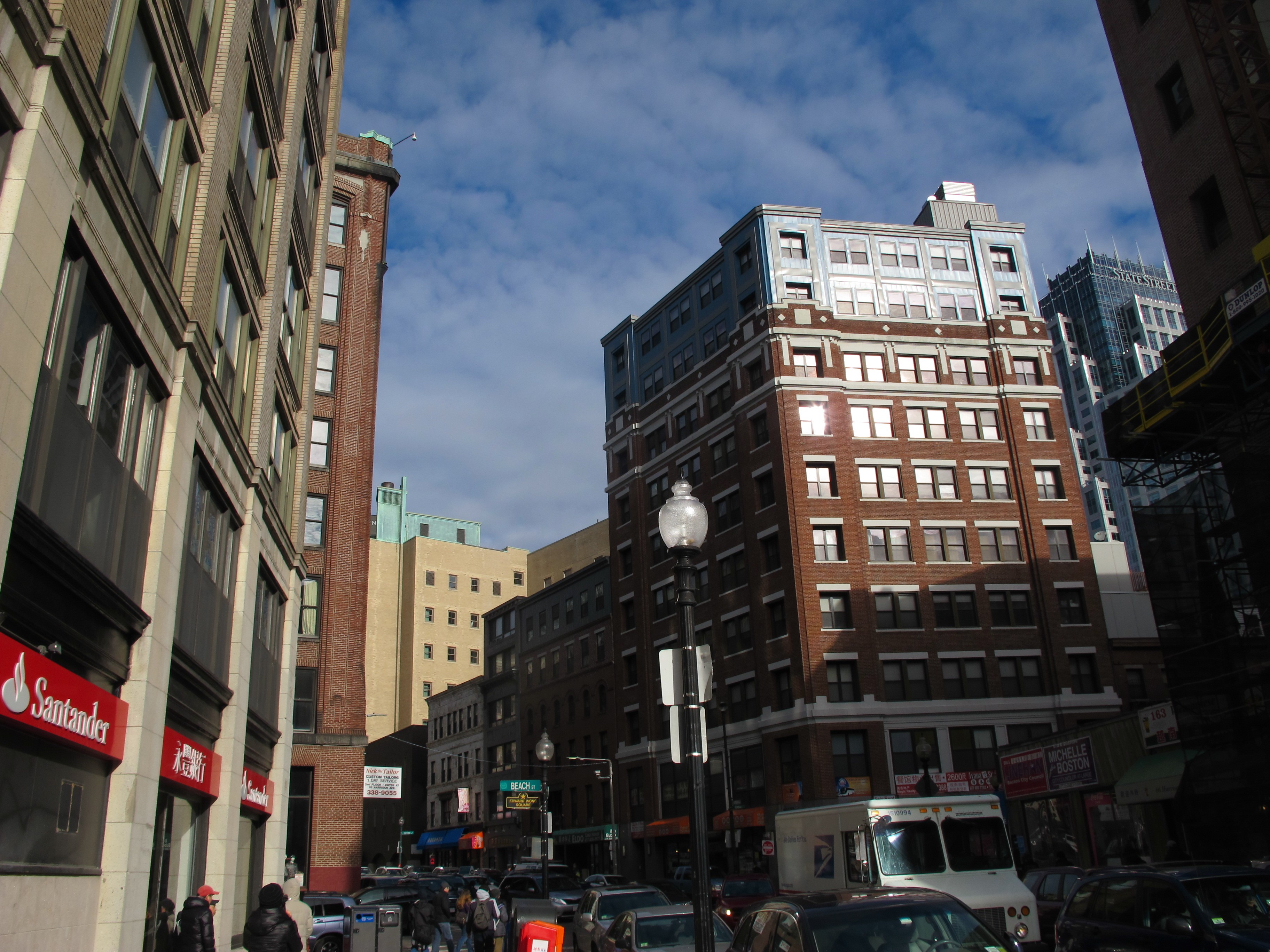
Looking north on Harrison Ave. intersection with Beach St. This shows that all four corners were dominated by garment buildings with large windows on two sides.

Leave a comment

1. Garment Dist. – Map – Randall Imai

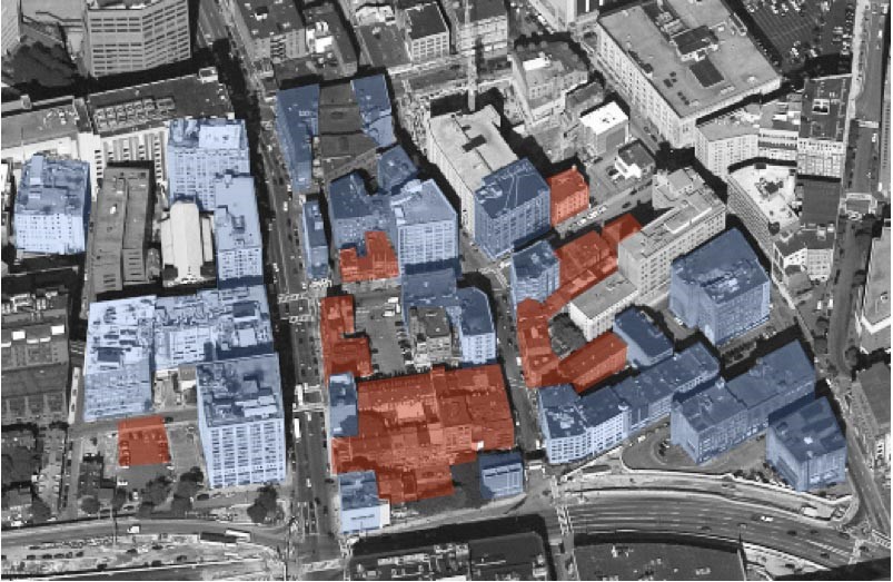
The distribution of garment buildings (blue) and Chinatown buildings (brown) circa 1930. Diagram by Randall Imai.

Leave a comment

CACA Tyler St 80s

Leave a comment

8. Chinatown Park

Leave a comment

7. CEEC

Leave a comment

6. Mount Hope Cemetery

Leave a comment

5. Wang YMCA

Leave a comment

4. Metropolitan

Leave a comment

3. Oak Terrace

Leave a comment

Posts navigation

← Older posts

Recent Comments

    Archives

    Categories

    • Community
    • Context
    • Elevations
    • Graphics
    • Personal
    • Stories
    • testcat
    • Then & Now

    Meta

    • Log in
    • Entries feed
    • Comments feed
    • WordPress.org

    Pages

    • About Us
    • Archives
    • Consolidation Era
    • Expansion Era
    • Home
    • Maps
    • Resources
    • slider test
    • Stories
    • Strengthen Era
    © 2025 Chinatown Atlas.