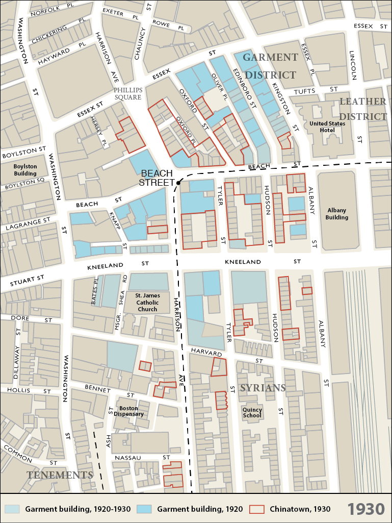
Today, the buildings in Core Chinatown and the area immediately south of Kneeland St. are a mixture of 1840s row houses and 19th and 20th century loft buildings. This was the result of the parallel expansion of both Chinatown and the Garment District in the same geographic area.
19TH CENTURY
Boston’s Garment Industry started in the mid 19th century as increasing urbanization raised demand for ready-made clothing and shoes. The Civil War further increased the demand for uniforms etc. In the late 19th century, the influx of Eastern European Jews and Italians brought entrepreneurs, skilled tailors and a large work force.
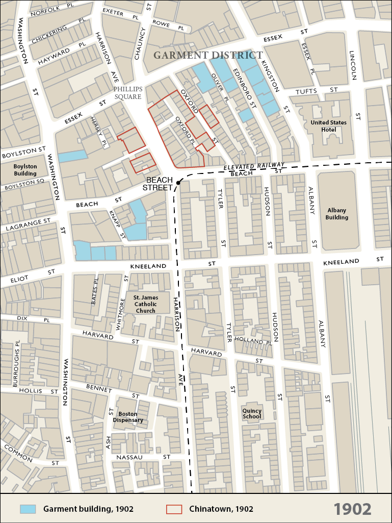
The 1872 Fire destroyed the earlier garment and leather factories. This led to relocation into the South Station and Chauncy Street areas. In 1898, sweatshops operating in tenements (mostly North and West Ends) were outlawed and work moved to loft factories. The industry expanded in the late 19th century south towards Essex St. At the same time, Chinatown was establishing itself on Harrison Ave. between Essex and Beach Streets.
1900-1917 GROWTH
The building of the El down Harrison Ave. and Beach St. in 1901 drove out residential uses (except for the Syrians and the Chinese). The drop in property prices coincided with the expansion of the garment industry in the early 20th century. The noise of the elevated trains was no hindrance for manufacturing but daylight was still necessary to supplement electric lights for the workers.
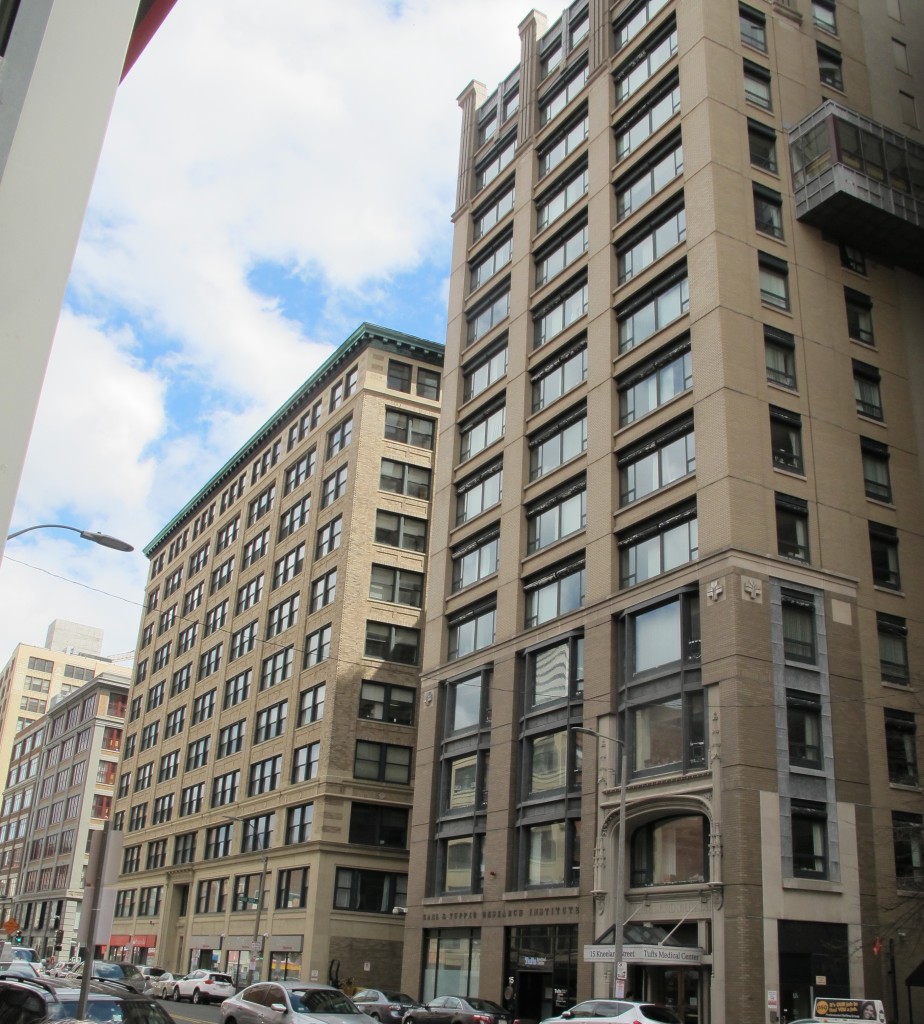
As a result, the first wave of buildings was about nine stories tall, steel framed with large windows. Corner locations with two outside walls were favored. Most notable is the intersection of Beach St. and Harrison Ave. – here was the station entrance for the El and five garment buildings. These displaced Chinese residents, establishments and restaurants that then moved around the corner to Beach and Tyler streets.
The street level stores were those that served the industry – sewing machines, buttons, textiles, embroidery, lace etc.
PEAK – 1920s
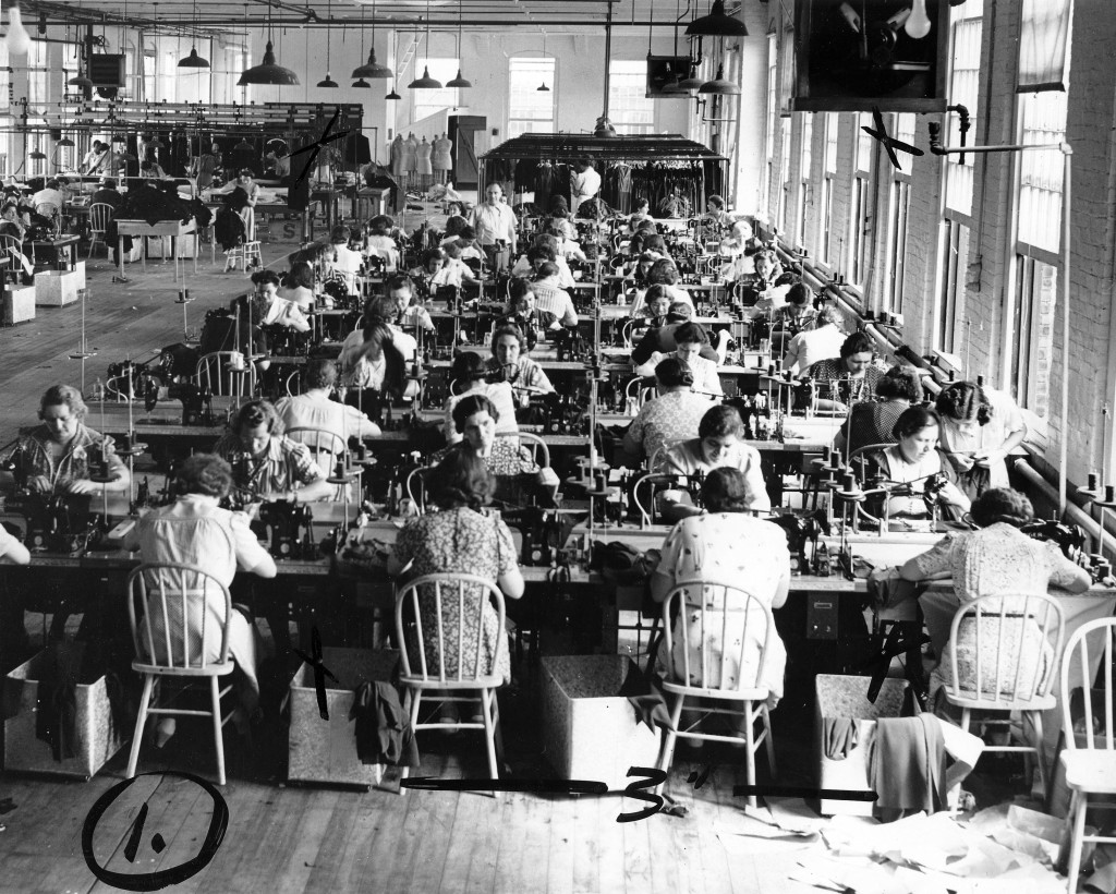
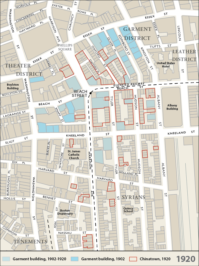
The industry continued to expand after WW I and reached its peak in the late 20s. The second wave of buildings was taller – 12-14 stories – with larger footprints as daylight became less important. These were built mainly on the south side of Kneeland St. where larger sites were available when Kneeland St. was widened. Unfortunately, at the same time that the industry was suffering from the dominance of New York and competition from other centers like Chicago, it was hard hit by the Depression. The Hudson Building at 75 Kneeland St. (with up-to-date Art Deco decorations) was finished in 1928 but was not fully occupied until after WW II.
DECLINE & THREATS
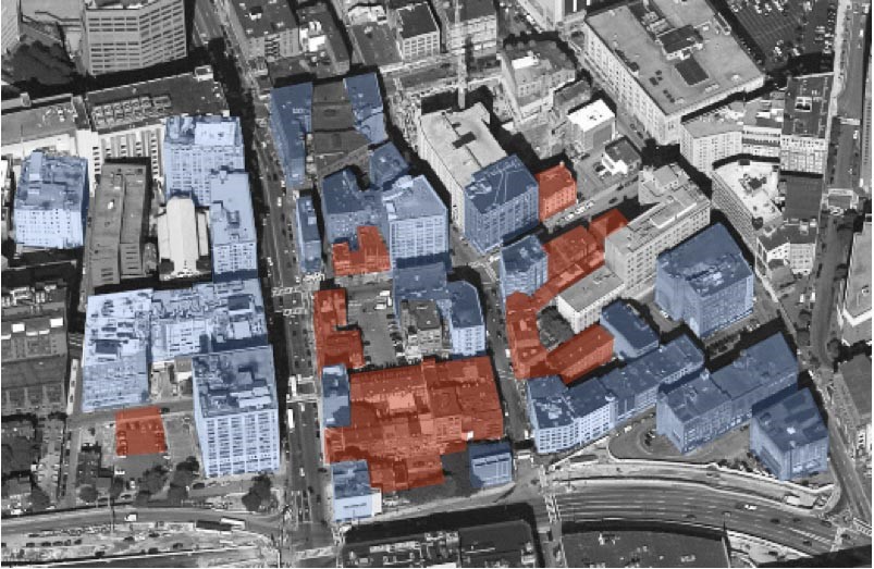
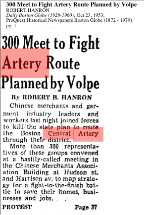
In 1952 the industry and Chinatown were threatened with oblivion by a proposal to build the Central Artery right through both. It would have taken out the majority of the buildings including the Hudson Building and left the survivors isolated next to a highway and its ramps.

Source: The Massachusetts Department of Transportation – Highway Division
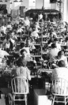
The industry joined with Chinatown to oppose the routing and most of it was spared. But it continued to decline. According to Anthony Tappé’s MCP thesis of 1958, the industry was still the largest in Boston and employed over 13.000 people. But by 1981, hampered by increased foreign competition, the industry had shrunk to 8000 workers. The traditional immigrant owners and workers moved to the suburbs and the second and third generations were moving onto the professions and white-collar work.
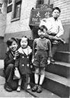
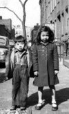
CHINESE INFLUX
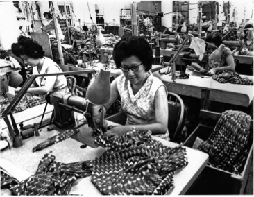
Up to WWII, there were few Chinese involved in the industry. Even though Chinatown and the garment factories were cheek-by-jowl with each other, there was no interaction between the two. There were a few restaurants like Yee Hong Guey and Ruby Foo’s that were popular among some of the owners. The reasons were the shortage of Chinese women and language and cultural obstacles. The influx of Chinese women after WWII and the 1965 Act brought large numbers of Chinese women (mainly from Hong Kong) who were skilled seamstresses and accustomed to factory work. It was the influx of this reliable work force that kept the industry viable even as it continued its decline. Finally in the 80s Tufts Medical Center and the University’s Dental and Medical Schools began to purchase the loft buildings and to lease the adaptable space at higher rentals.
END & RE-USE OF BUILDINGS
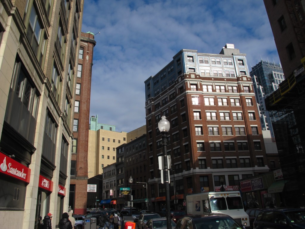
Today the industry is completely gone but the old loft buildings have been converted to other uses. In core Chinatown, they have been adapted for housing, family associations, offices and restaurants. The large spaces have been ideal for the large dim-sum restaurants like the China Pearl and Chow Chow City. South of Kneeland, Tufts Medical Center and Tufts Dental and Medical Schools have converted them to laboratories, offices, classrooms and other academic uses.
References:
Wai-han Mak The Female Chinese Garment Workers in Boston’s Chinatown
Boston University MS thesis 1980 (unpublished)
Tappé, Anthony (1958) The Ladies Garment Industry in Boston. Unpublished MCP Thesis MIT
EDIC/BOSTON (1981) The Garment Industry: Will It Survive In Boston?
The Great Workshop
Maps by Beehive.